
Barthauer Software GmbH
Software for geoinformatics and water management
Head Office Braunschweig
Pillaustraße 1a
38126 Braunschweig
+49 (0)531 23533-20
+49 (0)531 23533-99
info@barthauer.de
barthauer.de

For enquiries, please contact
BSS Technologies
Plot No: TP010524,
Technopark, Jebel Ali
+ 971 4886 7015
+971 4886 7013
barthauer@bsstechnologies.com
bsstechnologies.com
Barthauer Software GmbH is a medium-sized company that has been operating in the German-speaking regions of Europe for over 25 years. More than 1,000 customers are now using “Barthauer software”. About 40 employees are dedicated to the maintenance, development and support of the company’s leading product, the database-driven pipeline management system BaSYS.
Our motivation is the fair allocation and conservation of resources. We make information available over generations. We support our customers in the responsible use of scarce resources through infrastructure information solutions.
Modeling and efficient design of individual information systems for geo infrastructures - Software for design, operation and management of supply and disposal networks.
With comprehensive functionality, flexibility, and practical benefits – especially in the water and waste water segments – the professional and efficient pipeline management system is used for infrastructure planning by civil engineers, the employees of special purpose associations, municipal organisations and public services.
Through its “multi-platform concept”, the company offers integration with the GIS/CAD systems of leading global manufactures such as Autodesk, ESRI, Intergraph and Bentley via a uniform user interface. With MS SQL Server or Oracle, Barthauer offers its customers a choice of two database management systems.
In conjunction with the waste water work group formed by the German state building authorities, Barthauer has been developing and implementing the current, “original” ISYBAU interfaces for comprehensive transfers of technical sewer data between customers and vendors since 1991.
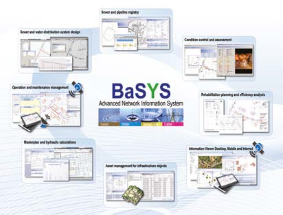
- BaSYS covers all aspects of supply or removal network lifecycle
- Powerful network planning and design functions
- Common GUI for all major CAD / GIS platforms (ArcGIS, ACAD, Bentley Microstation, Intergraph Geomedia)
- Asset registry
- Condition control and assessment
- Rehabilitation planning
- Asset evaluation, amortization
- Hydraulic masterplan
- Operation and maintenance
Download : Full Catalogue